The update to Innisfil’s Transportation Master Plan (TMP) is “a lot” and “ambitious.”
Councillors got their first look at the recommendations from RJ Burnside during their June 22 meeting. The presentation was for awareness and to consider questions from council. The plan will be submitted for approval at the Aug. 10 meeting.
The new plan is the third for the town since 2013 and increases its focus on active transportation throughout the community. During the public consultation undertaken for the TMP, the public particularly showed an interest in improving the ability to travel by foot, bike or other non-motorized methods throughout Innisfil.
A town with the physical size of Innisfil can pose some challenges in creating a cohesive active transportation network. The plan calls for more protected, multi-use trails in the more populated areas while utilizing paved shoulders in less-populated sections of the town, as well as support for the “around the lake” trail plan, which will require partnership with neighbouring municipalities in both Simcoe County and York Region.
By 2041, multi-use trails are proposed for Mapleview Drive from 20th Sideroad to 25th Sideroad and for Big Bay Point, from 25th Sideroad to Lake Simcoe, with paved shoulders along two sections of 10th Line from 10th Sideroad to 20th Sideroad (cut in the centre by Stroud), 4th Line from Churchill to County Road 27 and 7th Line from Yonge Street to 10th Sideroad.
A sidewalk gap analysis was also completed during the TMP process, particularly focusing on the Lefroy and Alcona areas. This is a big step in making walking safer, as newly built communities are completed and homes are filled-in, said Coun. Donna Orsatti.
“It is key and residents will be so pleased to see this and will be asking ‘when is this going to happen?’” she said. “We need to provide safe methods for residents to get to different areas because walking on the side of a road, on a bicycle path, is not safe."
One of the benefits of paved shoulders in less densely populated areas is that they can better accommodate other modes of travel, including agricultural vehicles and buggies, explained Ray Bacquie of RJ Burnside, who presented the plan to council.
That was important to hear for Coun. Ken Eisses, who was concerned agricultural transportation was being forgotten in the TMP.
“I was glad (Bacquie) mentioned some improvements on east-west lines where agricultural equipment needs to travel… (but) there have been concerns from the agricultural community that especially going north-south – the 20th Sideroad is a good example – that some of our farm equipment has difficulty with some of the design,” Eisses said. “It’s the transition phase; I know that’s the challenge. On the 20th, we’re going to start the urban side, so we put curbs and everything up. Then we put a guard rail because of increased traffic. But we haven’t widened the road yet, and that takes another two years. In the meantime, there’s a real challenge and I do know of some accidents that have happened because of those situations.”
Vehicle transportation remained top of mind for many councillors when discussing the report, as the TMP outlines a variety of infrastructure needs to address the growth coming to Innisfil in the next 30 years. The plan calls for 17 projects on 12 different roads, ranging from widening to full reconstruction.
As more vehicles take to the roads, capacity limits will be stretched thin, with Innisfil Beach Road, in particular, facing the brunt. The TMP indicates the road may actually be required to widen to six lanes to accommodate traffic by 2051, which town staff has recommended against, “stating no arterial roads be expanded beyond four vehicular lanes (five with a turning lane) to keep Innisfil liveable and sustainable.”
There are several factors the council of the day will need to consider.
“It would really fall to the next level of study, the Class (Environmental Assessment), to balance the impacts with the operational needs. Where there are constraints, those operational benefits may not outweigh the impacts to adjacent properties,” explained Bacquie. “Those same studies would also have to weigh the merits of the additional capacity with the implications for the land-use planning (and) urban design of those streets.”
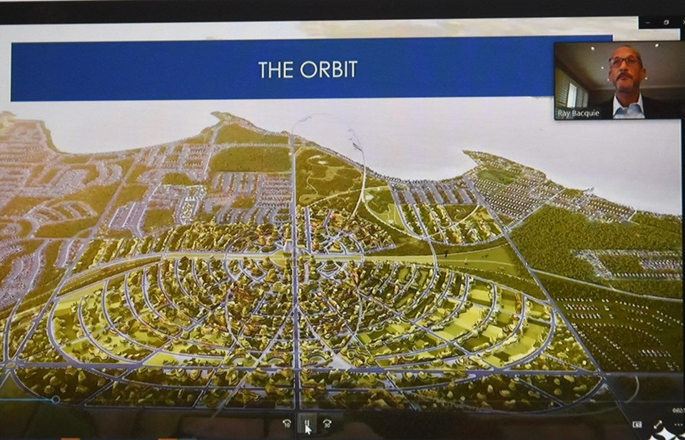
The impact of the Orbit development played a role in the TMP, and the associated changes required as it becomes a reality and tens of thousands of people come to the area. The plan addresses the need to transfer a portion of the 6th Line to the County of Simcoe jurisdiction, as well as the construction of an interchange at 6th Line and Highway 400.
While a GO Train station is still proposed for the Orbit lands, the current crossing at Innisfil Beach Road remains a concern for the town. Eisses wondered why more wasn’t being done in the plan to address removing the at-grade crossing at the 20th Sideroad.
That’s still the plan, explained Carolina Cautillo, project manager of roads, traffic, and transportation, but the timeline is murky, due to reluctance from Metrolinx to financially support the construction. However, the intersection of Innisfil Beach Road and 20th Sideroad is a “hot spot for collisions” in the community.
“The county and the town have come to an agreement on what that intersection should look like in the near-term and the county is doing that work as part of their four-laneing on Innisfil Beach Road,” she said. “If you look at the actual volume of traffic and the number of trains, a grade separation would normally be warranted at that location because of the exposure between vehicles and trains. We are still – and have always been – in favour of an eventual grade separation that location at some point in the future.”
The full draft TMP, which also focuses on the future of public transit in Innisfil, is available here.


